Cadastre

A plan for registration is “a plan that defines boundaries of land and their territories and scrip, within the meaning of Chapter 4 of the Planning and Building Law, which is part of its documents, is used for registration purposes by the method of registration of property rights, or first registration, or registration by the banknotes method” (Survey Regulations, 2016). ).

A registration plan presents operations for consolidation and division of plots, in the field of one registration block, and / or transfer of plots from block to block, in accordance with planning schemes, such as; National Outline Plan (TAMA), National Infrastructure Plan (NIP), District Outline Plan, Local Outline Plan and Detailed Plan. The plan is used to regulate the distribution of land in accordance with these plans so that, later, it can register ownership in the right area of the land in the name of the right owner.

Preparing plans for registration is of critical importance in regulating the proprietary status of the land. Among other things, this issue has received significant incentive in recent years from government ministries and government companies, which are working to correct years of neglect and register roads & rails land as the state possession. In the Ministry of Construction and Housing and the Israel Lands Authority, which manages and promotes most of the construction in Israel, the preparation of the PDO is an integral part of the job of the site surveyor. This is in recognition of the importance of the process for achieving the ultimate goal – accurate land registration, after the right owner of the land.


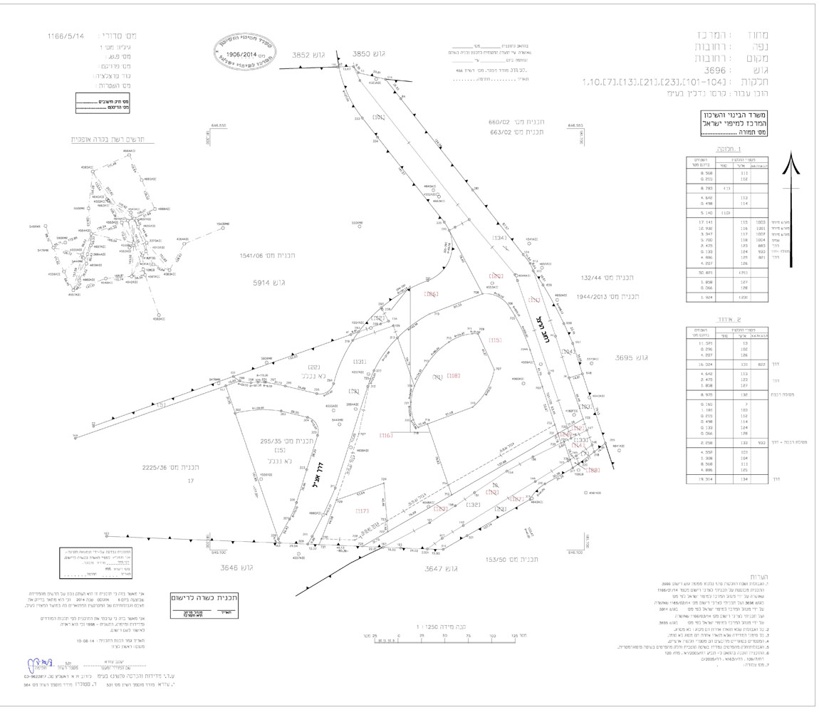
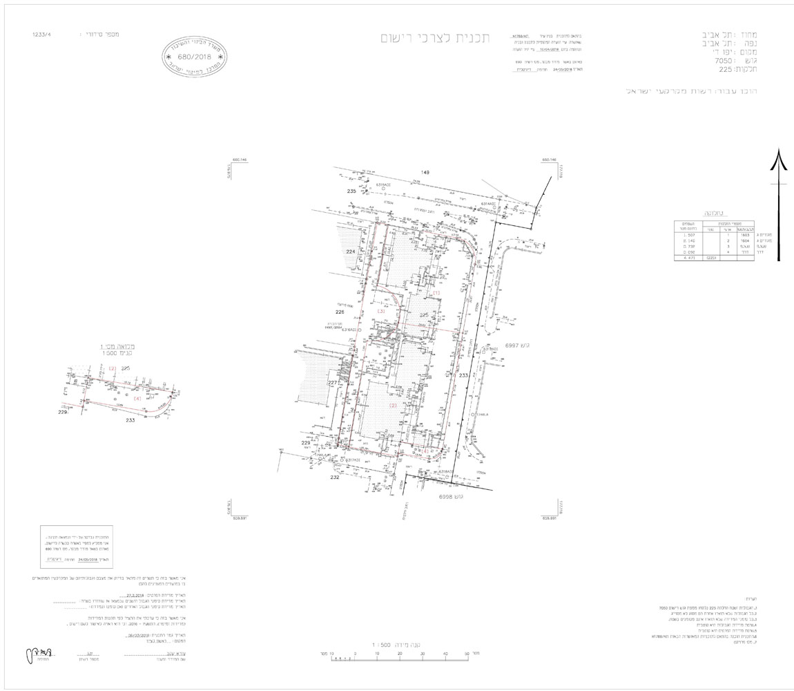
Preparing plans for registration is important for apartment owners – obtaining mortgages, selling the property and more; For contracting companies – freezing guarantees by the state; for government companies, contracting companies and factories – delaying building permits and / or populating; for the state – exposure to legal claims by landowners who have appropriated land; and more.

After the approval of the NIP, the Employer receives an authorised cadastre plan signed by the Israel Mapping Center and a document called the Land Registration / Land General Description. Using these two documents, the Employer can advance to the final stage of land registration.


תצ"ר כביש 44, הפרדה מפלסית 132, נתיבי ישראל
Road 44, 132 level separation, Netivey Israel
תצ"ר מפגש 139, רחובות
139 Junction, Rehovot
תצ"ר גוש 7050 תל אביב
The 7050 block, Tel Aviv